Visual City - A tool for sustainable urban planning
Future Cities Insight #13 Visual City - A tool for sustainable urban planning
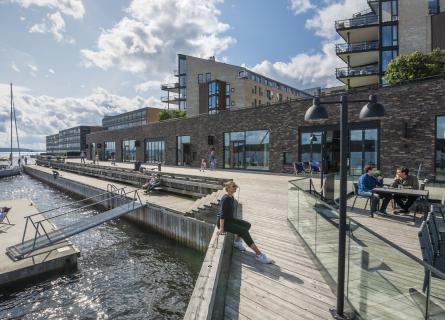
Future cities need to be sustainable cities. The complexity of that challenge calls for innovative new city planning methods. One of them is AFRY’s Visual City.
With the help of this flexible tool, AFRY can simulate and visualise various scenarios to find the best solutions for a sustainable and liveable city. This gives decision makers a better understanding of the impact of urban development and enables us to narrow the gap between today and the future.
Based on GIS (geographic information system) data and several types of smart modelling software, Visual City allows us to combine planning processes and incorporate urban development, landscape architecture, transport, mobility, noise, vibration, wind and pollution into a digital model. Within it, we can illustrate the consequences of various urban planning scenarios. The strength of the tool is how it shows the connections and dependencies between various issues. The focus point is always people, with their habits, needs and demands.
The process starts with the import of GIS data to map reality in a virtual model.
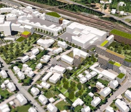
Using Esri CityEngine software, existing structures appear, and we can quickly see distances, topography, shadows and sunlight. Then we start experimenting! Suggested new developments take shape, through the input from urban planners, traffic planners, local stakeholders and anyone engaged in the process. New housing, roads and public buildings are added, through the use of AutoCAD or GIS software. As the suggested new development is integrated into the model, we can charge each structure with data. A house constitutes an area, from the area we calculate how many households that will fit. In each household, we predict the number of residents according to local demographic data. The number of people is then connected to an estimate of the number of travellers using various transportation modes (bike, car, public transport) and need for public services such as kindergarten, schools and parks. Rather than producing one memo for traffic, one for air and one for noise, Visual City combines them all and evaluates the total impact. The tool is therefore ideal for testing various solutions to urban planning challenges. We can instantly simulate scenarios to produce answers to questions such as: What would happen if a large majority were to choose public transport? At what point will the local bus system reach maximum capacity? Will existing schools be able to absorb suggested additional population? How can we create the best environment for children?
To ensure that a city is truly sustainable, we need to take into account the human, financial and environmental impact of every planning decision. The purpose of Visual City is therefore to test proposed solutions in relation to other aspects of urban planning.
Cecilia Windh, Urban Planner and Facilitator Visual City