Danube Flood-Risk-Mapping
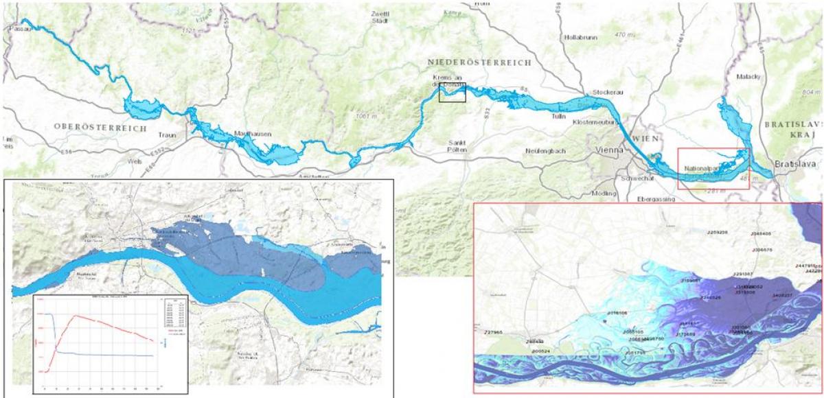
The objective of this study was the preparation of inundation maps for 30/100/300/1000-year floods for the Austrian part of the Danube River.
The flood scenarios have been simulated by applying a 2D-hydrodynamic model.
The results of the hydraulic simulation have been analysed with respect to flooded areas and inundation depths. For this purpose, the simulated water levels were intersected with airborne laser scan terrain data. The results were finally presented as GIS maps.
- Over 360 km river length 2-dimensional hydraulic simulations were computed with the program HYDRO_AS-2D.
- Pre-processing of the computational grid using the software packages SCOP++ and SMS (Surface Water Modelling System)
- Post-processing was conducted in SMS
- ArcGIS was used to generate maps of flooded areas and maps of inundation depths
- To consider the spillway operation rules of the 9 run-off-river hydropower plants at the investigated section of the Danube river, a separate software module was developed.
Facts to Project
Client: via donau Österreichische Wasserstraßen-Gesellschaft mbH
Umweltbundesamt GmbH
Services:
- Adaption of the computational grid
- 2D-Simulation about 360 km river and floodplains
- Mapping of flooded areas and inundation depths
- Implementation of spillway operation rules for the Danube HPP’s in the hydraulic model
Project period: 2011 - 2012
Location: Austria

Rudolf Faber
Project Manager, Hydro Consulting, Hydropower
Interested in our offering? Contact us!
Contact Rudolf Faber
For sales enquiries, please complete this form. For all other enquiries, please visit our
office and contacts page here.
